Chile has been spectacular and is truly a beautiful country to visit. We started in the Central Valley region exploring Santiago and Valparaiso. We travelled far into the Pacific Ocean to see the moai of Rapanui. And far north into the Atacama to see volcanoes, deserts, lagoons and salt flats. And finally we headed south to Patagonia, travelling along the ‘End of the World’ road, through bleak steppe to the sensational Torres del Paine National Park. The sights have been awe-inspiring. The food and people have been lovely and it’s all-round a fascinating country. For anyone thinking of making the trip here – absolutely do!
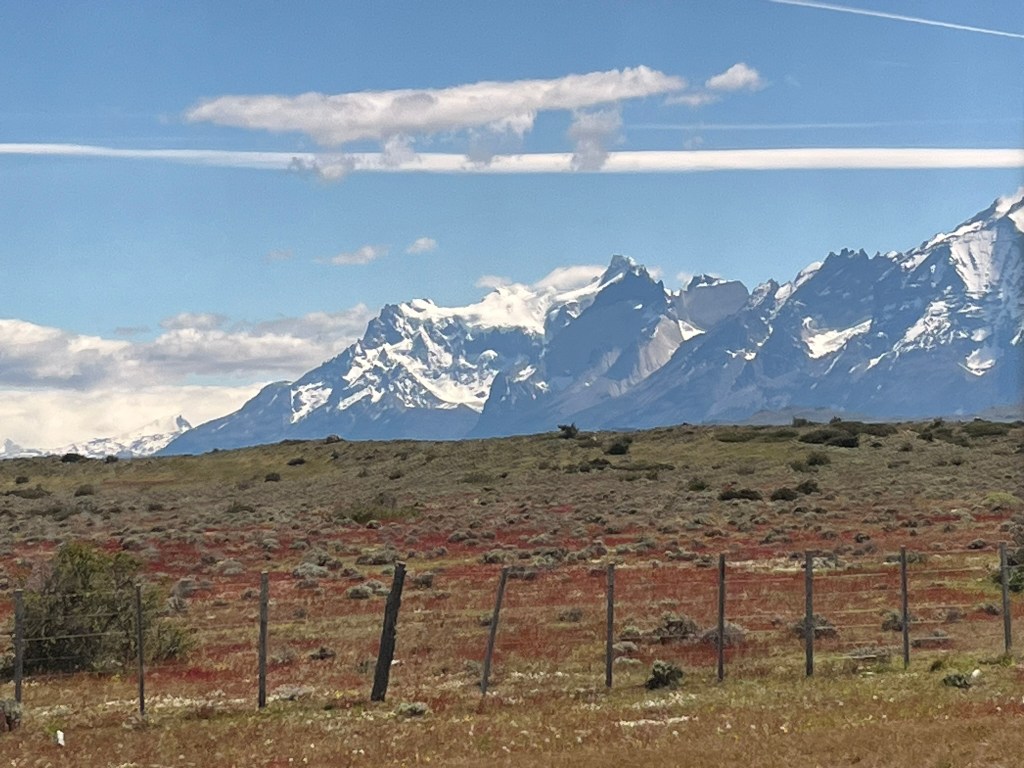
But now it is time for us to depart and cross the border into Argentina for the second leg of our month-long trip in South America. This afternoon we departed Torres del Paine, looking back as many times as we could, to get one final glimpse of the infamous granite towers. Back on the ‘End of the World’ road, the weather and scenery felt a million miles away from what we had experienced when we arrived to the park 3 days prior in hurricane winds and lashing hail. I remember worrying what would happen if the weather stayed like that for our entire time here and wondering why I had decided to only pack a fleece and no coat for the trip. But luck was on our side and the storm passed that night and we were treated to 3 days of clear skies and brilliant sunshine.
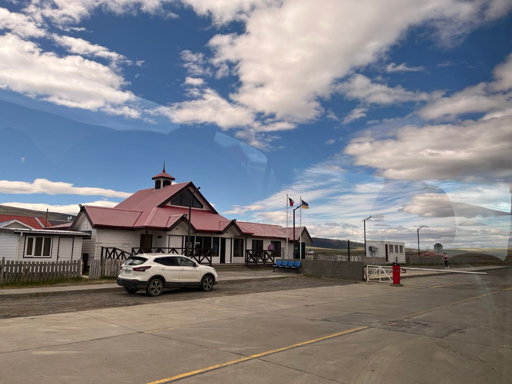
About an hour from the park, we reached the Chilean border control. Although you wouldn’t have guessed it was the border without the driver telling us to get our passports and follow him. There was just a simple barrier and a small building where migrations offices stamped us out of Chile. You then drive a few kilometers across flat steppe to reach the Argentinian border post of Cancha Carrera. And after a few more kilometers we met our new driver and switched our bags over to our new vehicle.
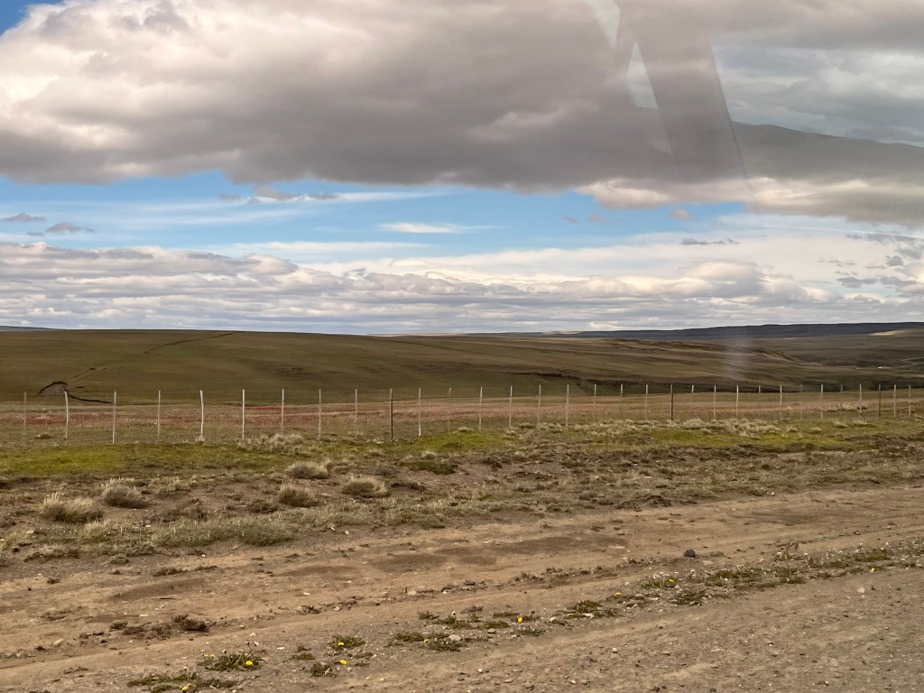
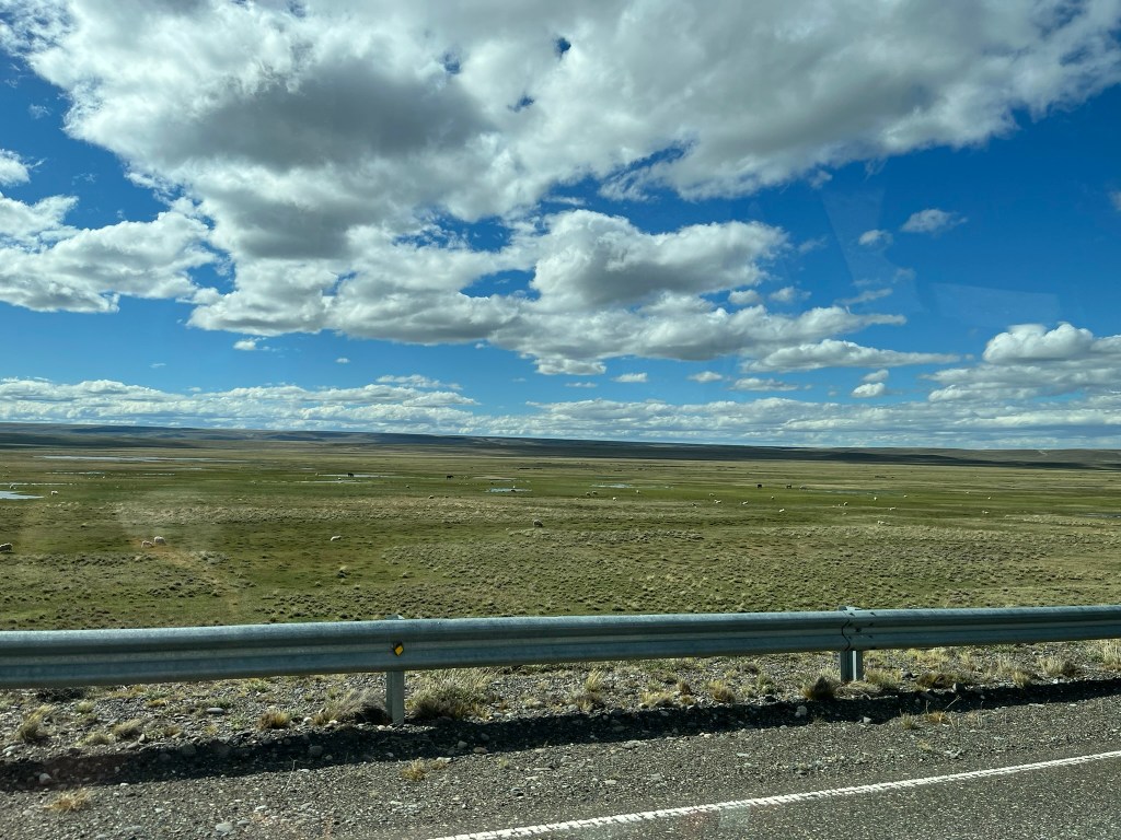
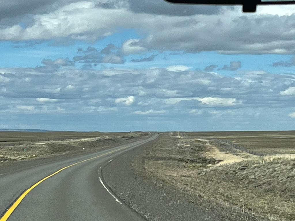
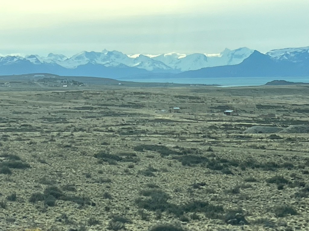
From here it is a long 3 hour drive to El Calafate through Argentinian pampas. This sounds romantic, but this is an incredible bleak, never-ending landscape of steppe as far as the eye can see. The road is straight and disappears into the horizon and there is very little variation in the scenery. I guess you need to experience this to truly understand how empty Patagonia truly is outside of the major towns and sights. You can however, get great views back to Torres del Paine, which are over 100km’s away but still visible in the distance. And its possible to see a fair bit of wildlife – herds of Guanaco, Darwin’s rhea (a kind of small ostrich looking animal) and birds.
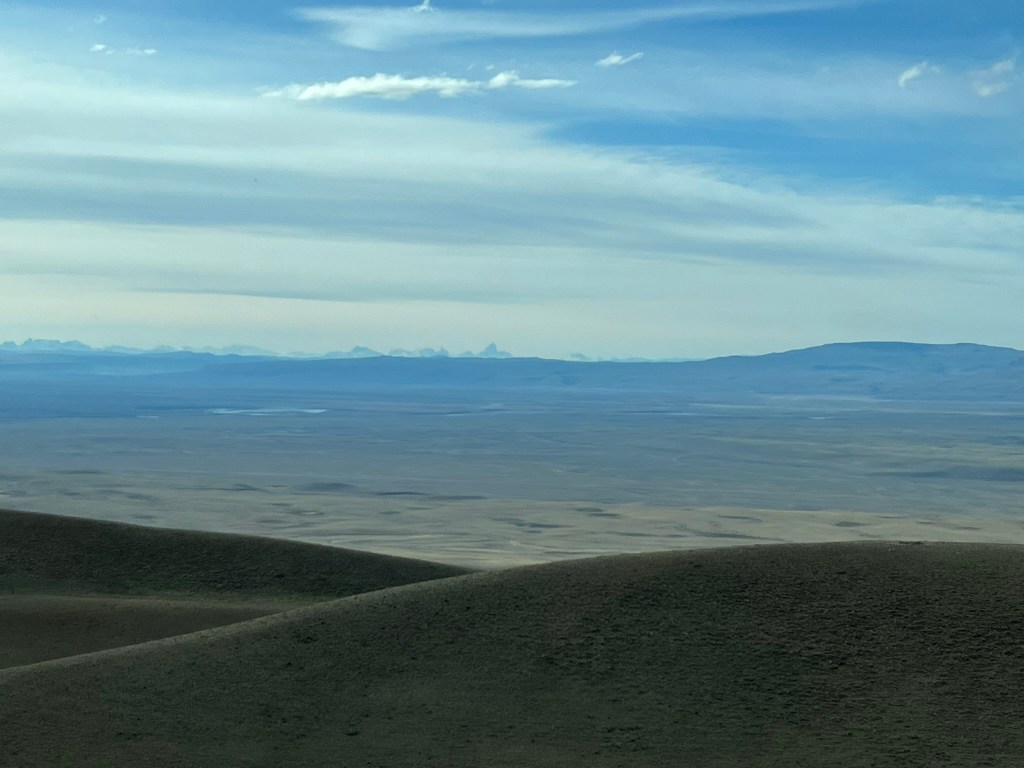
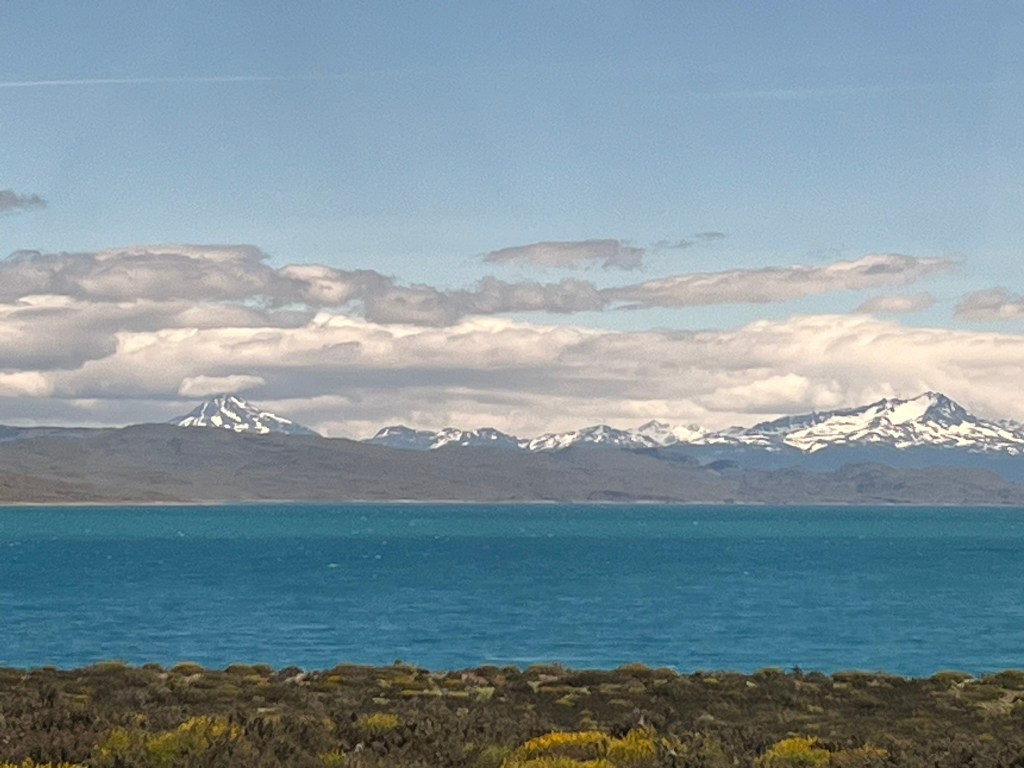
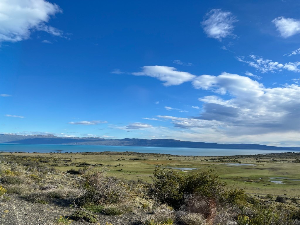
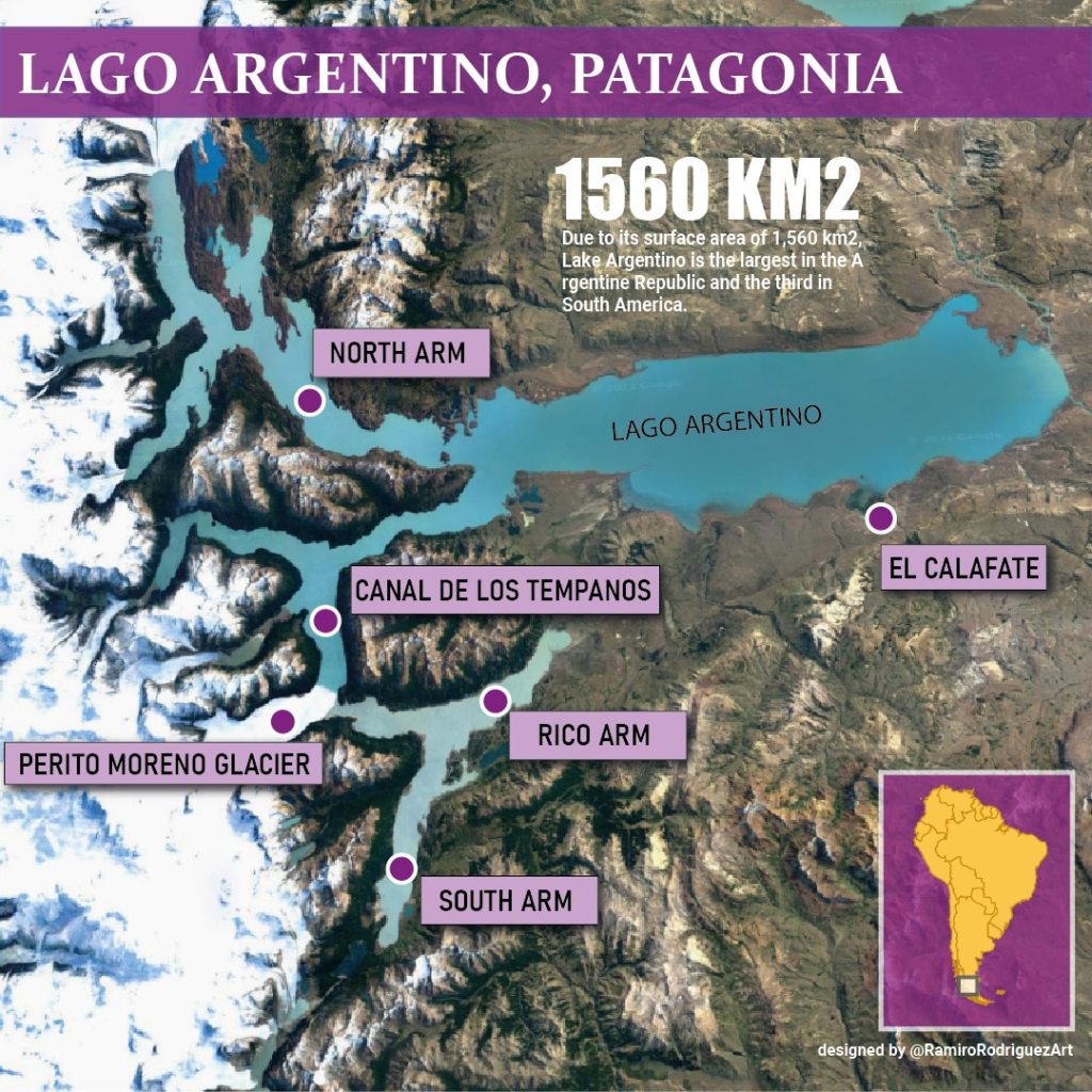
It’s a relief when you start descending into the huge valley that Lago Argentino sits in. After endless, wind-scoured steppe, the landscape quickly changes to U-shaped valleys, terraces and rounded moraines. You see the first flash of turquoise and the enormous Lago Argentino presents itself to you. This is the largest lake in Argentina and its brilliant blue color comes from the very fine sediment that is deposited and stays suspended in the water by the surrounding glaciers grinding bedrock.
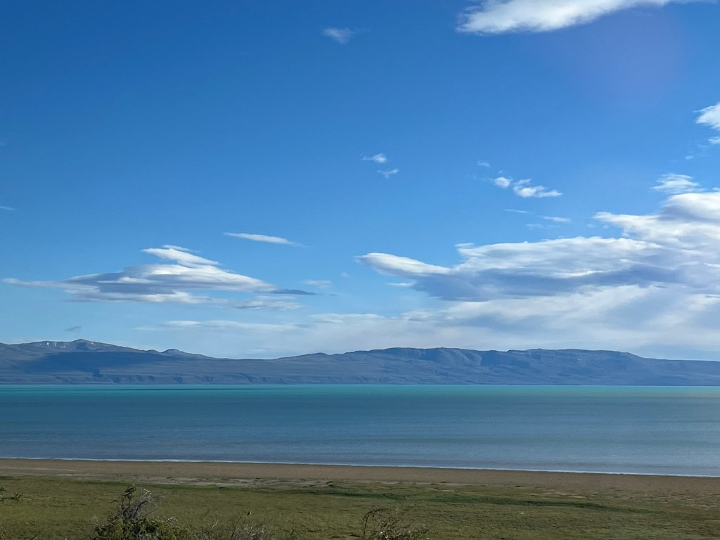
Lago Argentino lies in a huge glacial depression carved during the last Ice Age. Including its branches, the lake is 160km in length and 20-30km in width. It has a depth of up to 500m and a catchment basin on tens of thousands of square kilometers. The basin itself is about 40-50km in width. During the last glacial maximum a huge outlet glacier flowed east from the Andes and was up to 1km thick and filled the entire basin. As it advanced and retreated it bulldozed enormous amounts of material. When it pulled back it left behind a series of terraces, moraines and outwash plains, which you can easily see on the drive to El Calafate.
The U-shaped valley with its wide bottom, flat floor and steep rounded sides are what tell us that this valley was carved by a glacier and not a river. The giant terraces are old shorelines from glacial lakes that existed long before Lago Argentino took its modern shape. The terraces are where the ice paused and dumped sediment. The curved ridges of gravel, now colonized by scrubs and low steppe vegetation are the terminal and recessional moraines at the end of the glacier. El Calafate itself sits partly on a series of morainic terraces. The rounded hills, often tear-dropped in shape with smooth and polished surfaces from years of grinding against ice are drumlins and roches moutonees. You also see random enormous boulders that look totally out of place. These boulders sit alone in the steppe and were transported here by ice thousands of years of ago and deposited when the glacier retreated.
The town of El Calafate isn’t an ancient settlement or traditional Patagonian pueblo. It’s a modern frontier town that grew because it became the tourist gateway to the glaciers that feed the lake. It sits on the southern shore of Lago Argentino with low wooden houses, colorful tin roofs and rows of tall Andean popular trees. The streets are arranged in a grid and cafes, souvenir shops and tour operators are concentrated along the main street – Avenida Libertador. Theres an energy in the town, of tourists excited to get out an explore.
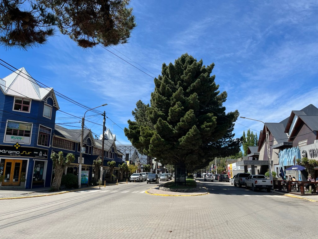
The town gets its name from the calafate berry, a deep purple berry that grows on a spike Patagonian shrub. There is a local legend that says if you eat the berries you’ll one day return to Patagonia. As I had already had a calafate sours and a number of calafate lemonades on the Chilean side of Patagonia I expect I will be back some day! We will be based in El Calafate for the next 3 nights, with day trips planned to Glacier Upsala and Glacier Perito Merino.

Leave a comment