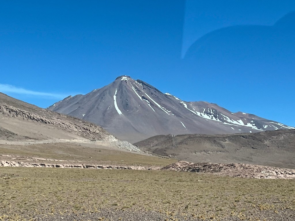
It was an early start today, departing our hotel at 6.45 for a full day’s adventure out into the Atacama. As we left town with the perfectly conical Licancabur volcano looming over us, we quickly gained elevation to get a sweeping view across the Salar de Atacama.
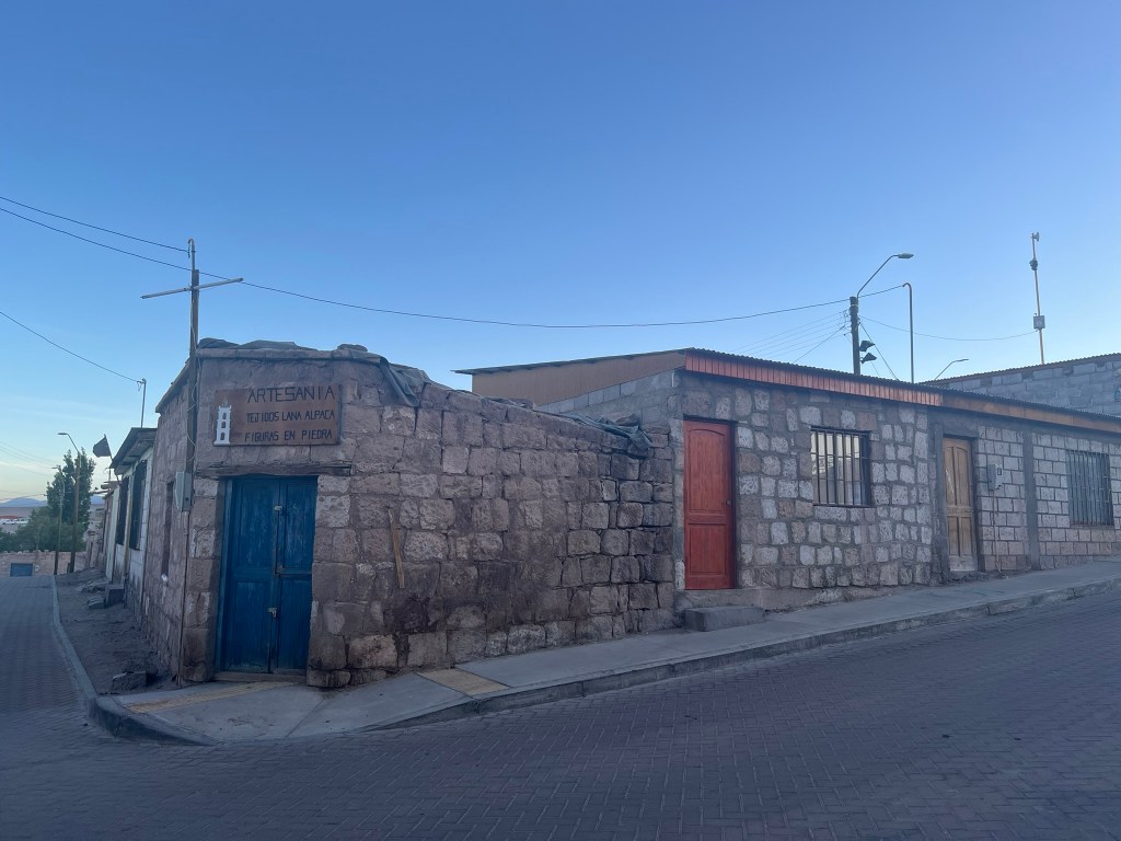
We stopped after about 30 minutes in the small village of Toconao to have our breakfast in the main plaza. I’m not sure how the locals feel about 10 vans worth of people arriving at the crack of dawn each morning to have scrambled eggs and avocado in their small sleepy town. The town sits on the edge of a deep gorge, called the Quebrada de Jerez and is one of the only places in the region with enough natural water to support year-round agriculture. The village is surprisingly green, relative to the surrounding barren landscape. There is a pretty adobe-walled church and detached bell tower in the main plaza, dating back to the late 18th century and the houses are all built with local volcanic stone.

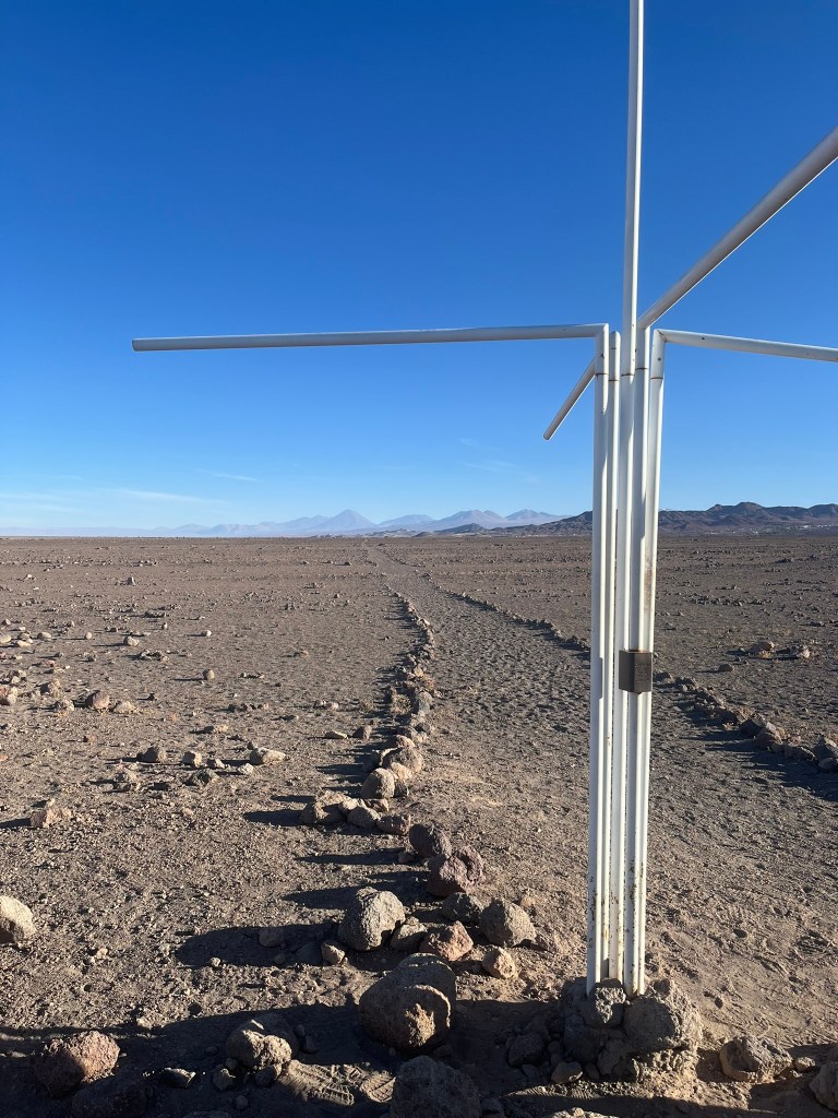
Our first stop after breakfast was at a roadside stop in the desert that marks where the imaginary line of the Tropic of Capricorn crosses the terrain. This signifies the southernmost latitude at which the sun can be directly overhead at the December solstice. What makes it interesting at this particular location is that the Tropic of Capricorn was actually very significant to the Inca, for astronomy, agriculture, cosmology and rituals. For the Inca, the solstices were major astronomical anchors, that marked agricultural cycles, defined ritual calendars and were linked to sun worship. The December solstice signified the start of the rainy season in the central Andes, and knowing when the sun reached its southern-most extreme, helped with the timing of planting and organising labor. Today, traces of an original Inca road run parallel along the highway, right by this Tropic of Capricorn marker. The path is clearly delineated with rocks marking its edges.
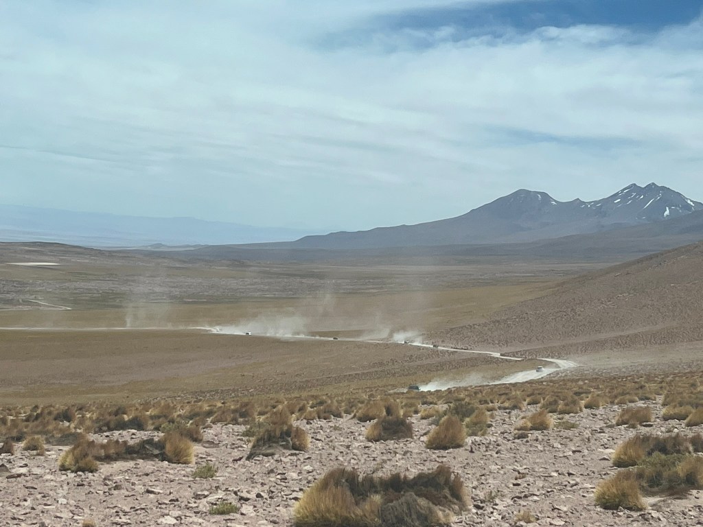
From here we started our climb up to the altiplano of the high Andes. I’ll admit at this point I was asleep, but I did see later on our way back down the spectacular views At the terraced-farming town of Socaire, tour groups must stop to sort out permits for entering the park. After that the landscape changes again, with broad, empty high-altitude plains and volcanoes surrounding you on all sides. Its brilliant!

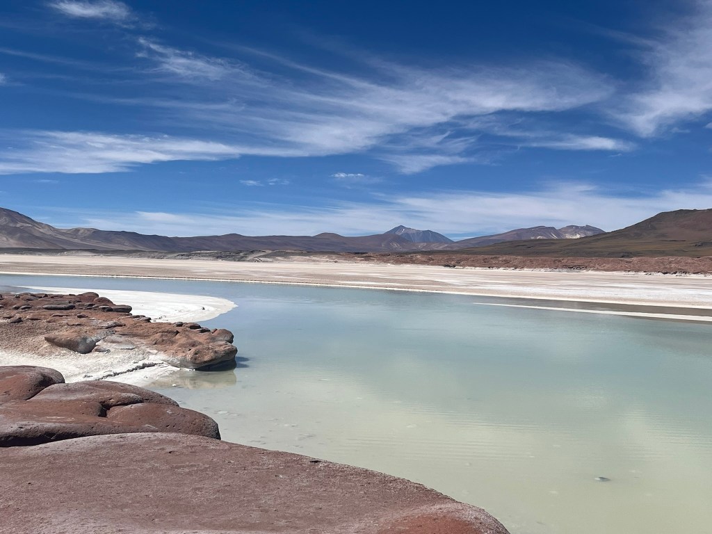
The red rocks (or piedras rojas) are a plateau of oxidised, iron-rich volcanic rock that look all sorts of shades of red depending on how the light catches the ground. The plateau sticks out into the Salar de Talar basin, a huge white salt flat that spreads out into the horizon like a frozen lake. There are perfectly shaped volcanoes in every direction on the horizon. You truly feel like you are on another planet!

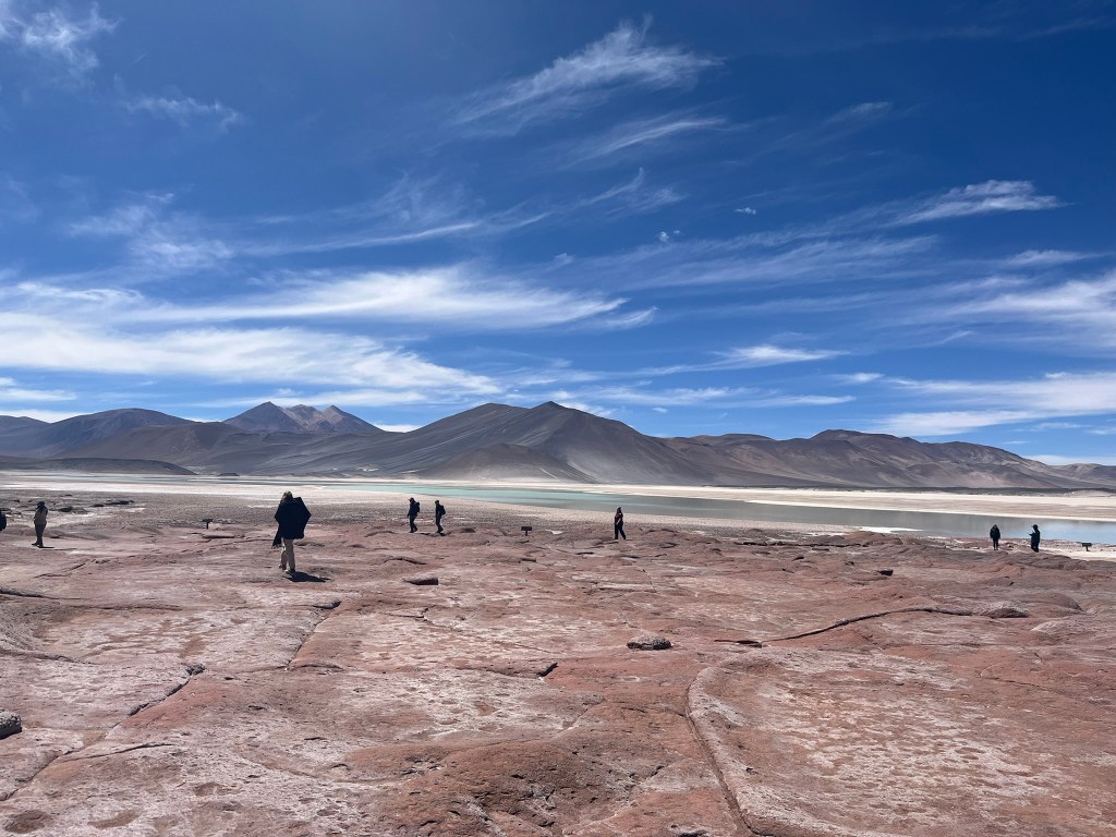
Millions of years ago, eruptions from nearby Andean volcanoes sent lava flows, pyroclastic material and volcanic ash across the plateau. This lava cooled into rhyolite and andesite, rich in iron-bearing minerals. Over time, oxygen, intense UV radiation and extreme temperature cycles caused the iron minerals in the rock to oxidise, the same process that turns iron an orange-red color when it rusts. High-altitude weathering, such as powerful winds, freezing nights and warm days, and salt crystals forming in fractures has shaped the rocks. This has sculpted the volcanic rock into smooth waves, rounded platforms and fractured blocks. The result is the beautifully colored and oddly smooth red-rock terraces we had come to see.
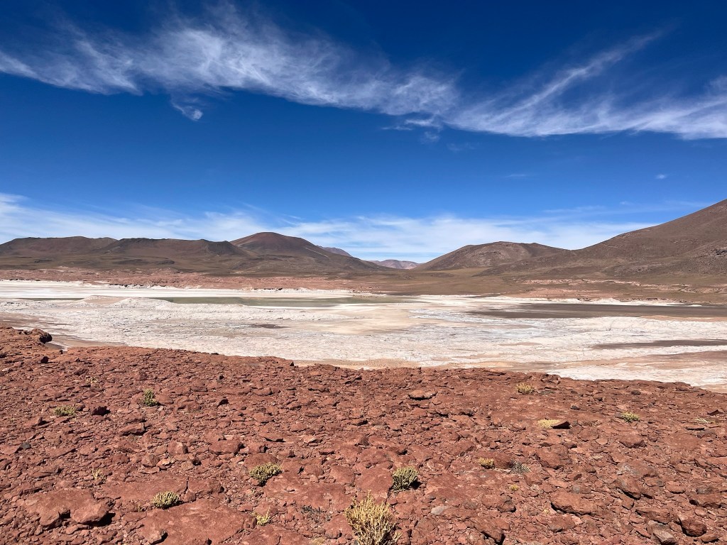
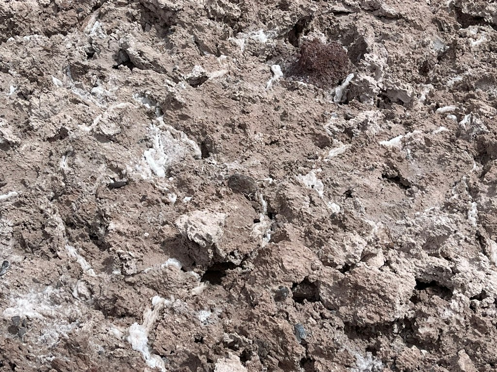
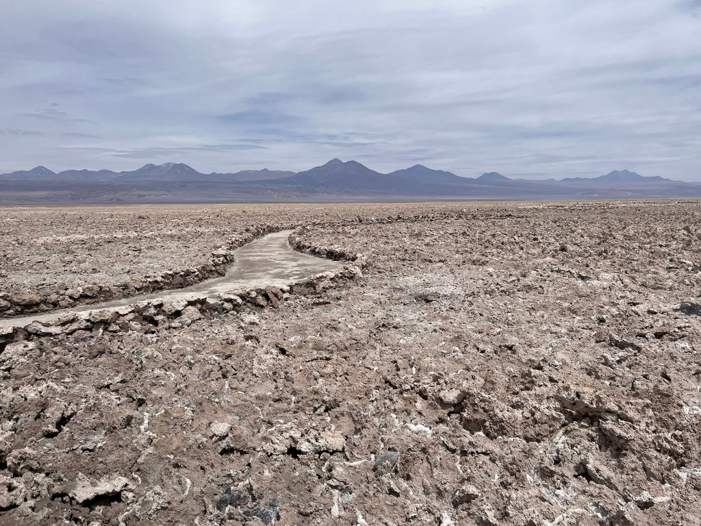
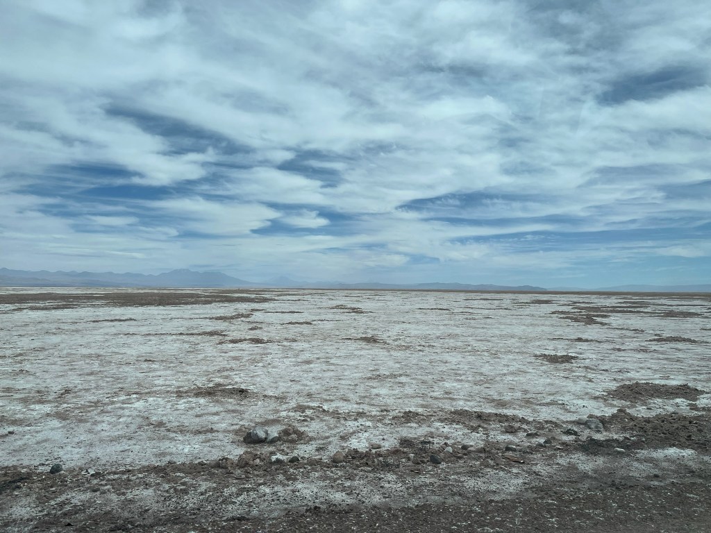
Salar de Talar is part of a high-altitude endorheic basin. A series of altiplanic bowls have been created as a result of the tectonic uplift of the Andes. Water cannot escape from this bowl and over time the basin has accumulated snowmelt, geothermal ground water and minerals washed down from the volcanic slopes. Because evaporation in the Atacama is the highest in the world, water disappears quickly leaving dissolved minerals behind. Over thousands of years, this process has repeated, leaving accumulations of sodium chloride, gypsum, borates, lithium-rich brines, calcium and magnesium salts. It looks like a thick-white polygon-cracked salt crust. And because there is almost no organic material at this altitude, the salt crust stays bright and unpolluted. Groundwater is still seeping to the surface, creating turquoise shallow pools, with the color changing depending on the mineral content.

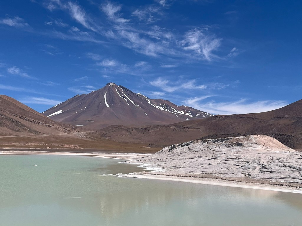
The walk down to the edge of the salt flat, takes you through the red rocks and takes about an hour in total. The guide suggested it would be a medium to hard walk, but it’s a gentle slope down to the shore and back up again and not that difficult at all. One thing to note is that you are at over 4000m altitude here and that affects folks in different ways. I think I was fortunate, since I had only a six weeks ago been in Tibet at high altitude for multiple days and maybe my body was able to adjust more quickly today. But I felt great, and didn’t even feel out of breath. The walk is really enjoyable and there are so many different colors, from the red of the rocks, to the green of the hills, and blue of the water…it’s quite magical.
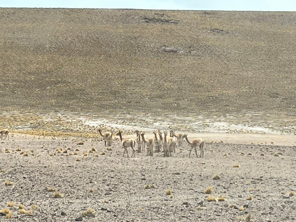
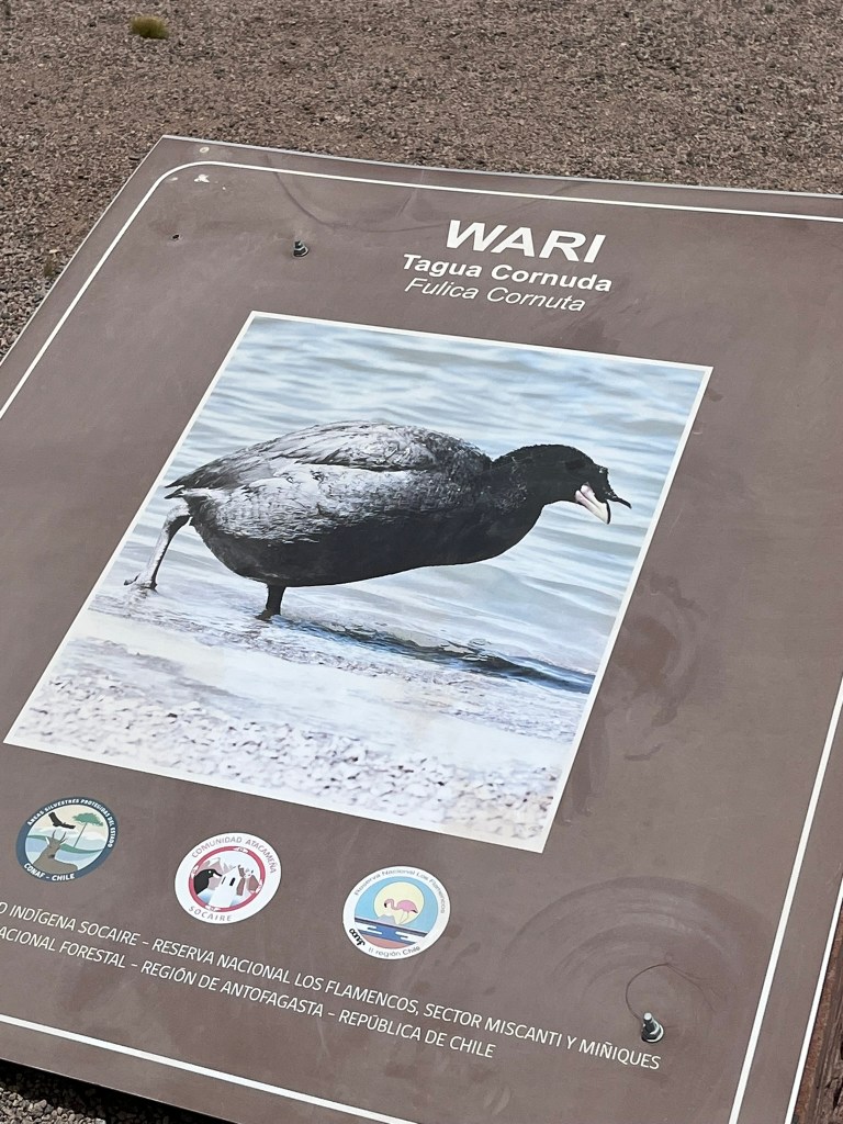
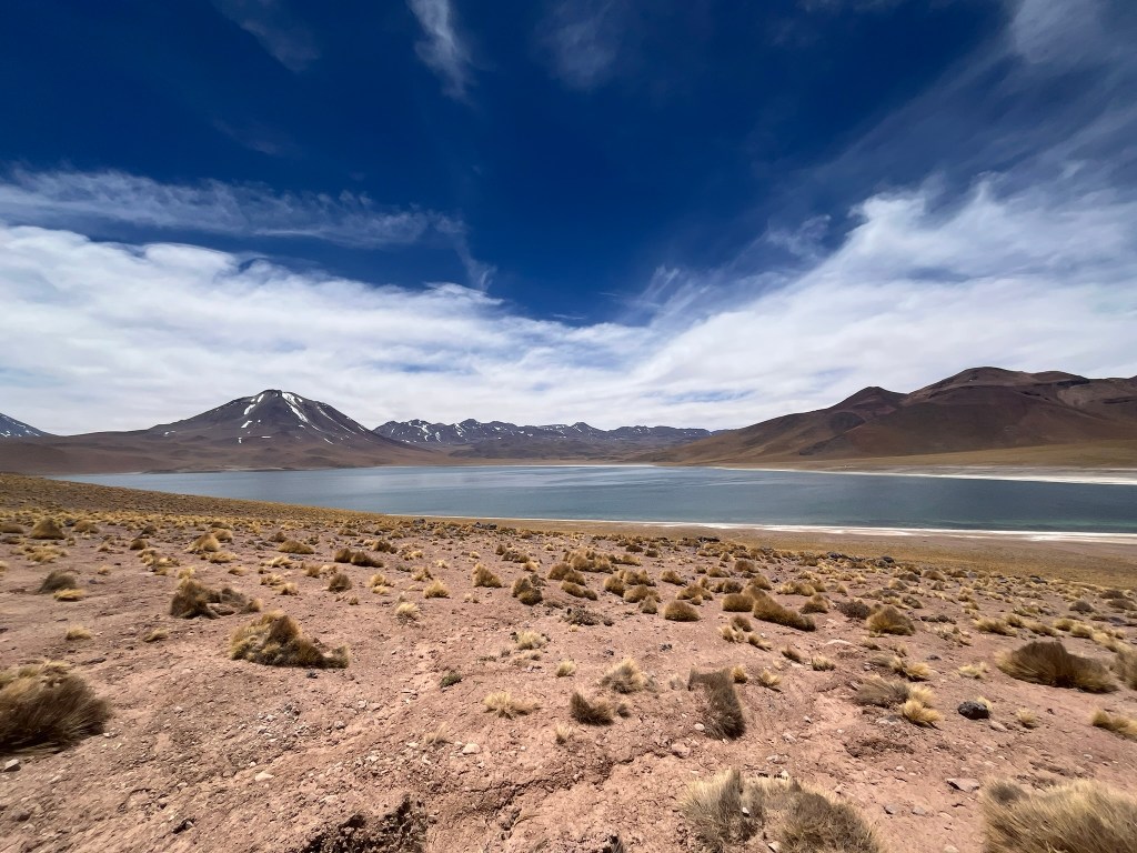
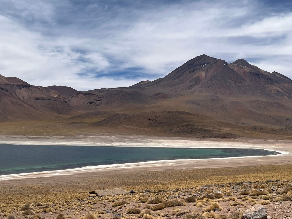
Next we headed to the altiplanic lagoons of Miscanti and Miniques. These are two high-altitude volcanic lakes that lie in depressions created by volcanic activity. Ancient eruptions from Miniques volcano produced lava flows that dammed the water basin, and glacial meltwater and snowmelt filled the depressions over time. They are an intense sapphire blue color because of the fine minerals that lie suspended in the water. At the shore of the larger of the 2 lakes, Miscanti, we could see Vicunas grazing. And the view of the 2 dormant volcanoes on either side of the lake was great. At the smaller lake, Miniques, we were able to see the Horned Coot in the distance. This strange bird, with a big unicorn-like horn on the front of its head, is actually a rare high-Andean species that only creates its huge stone nests around a few remote lakes in the region, including this one.


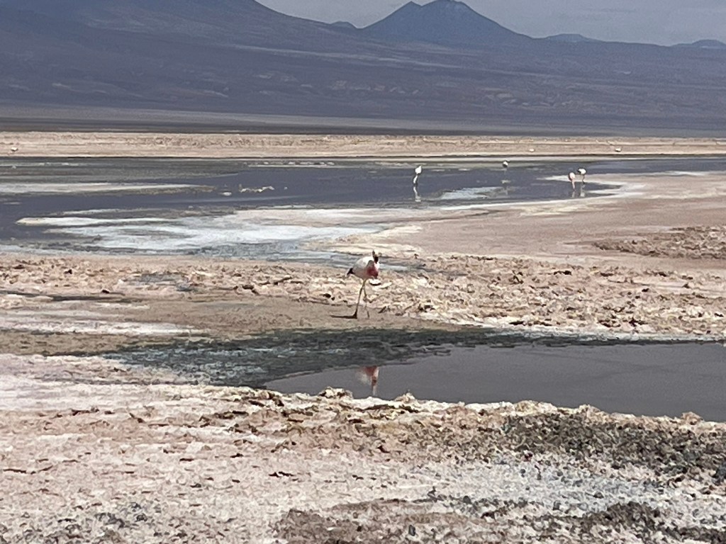
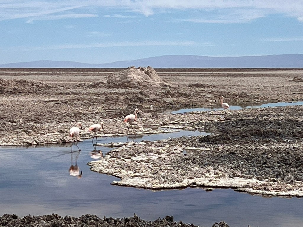
After a late lunch in the town of Socaire, we headed back towards San Pedro for our last stop of the day – Laguna Chaxa – to see the famous salt flats and the local population of flamingos. This is one of the most biologically important parts of the Atacama Salt Flats, and one of the richest feeding grounds in the high-Andes. The lagoon is full of brine shrimp, diatoms, halophilic algae and tiny crustaceans that thrive in the hyper-saline water. The lagoon is shallow making it easy for the flamingos to sweep their beaks down into the water and feed on these tiny creatures.
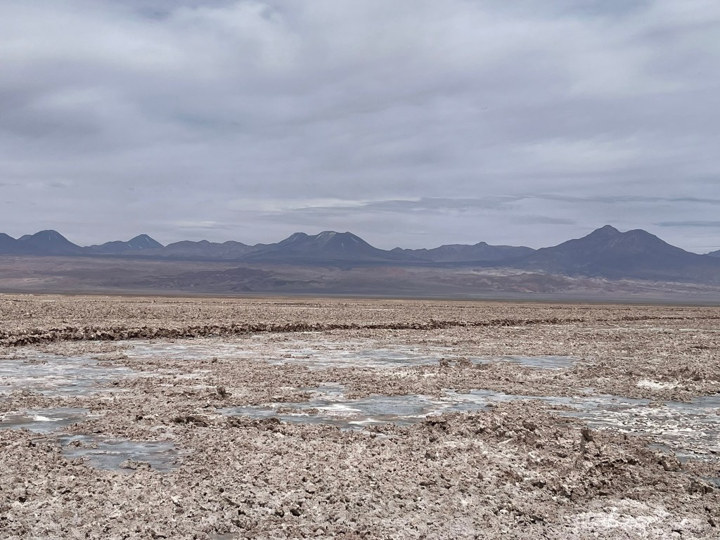


Because there are no predators and the salt flat is huge, this is an ideal breeding and feeding zone for the birds and means that it is one of the few places in the world where there are three different species of high-Andean flamingo – the Chilean Flamingo, Andean Flamingo and James’s Flamingo. They are such incredible birds and to see them walking around, pecking down into the water and spot the bright pink in their wings was brilliant. The walk through the salt flats is flat and easy, but be prepared to walk in the scorching head with no shade for cover!
The other interesting wildlife to see in the lagoon is the endemic Fabian’s lizard. It inhabits the edges of the salt-flat lagoons and has managed to adapt in one of the most extreme environments on the planet. Because it has evolved in relative isolation, it has adapted to its cold environment where egg incubation would be a challenge, by giving birth to live young instead of laying eggs like other lizards. This evolution is likely to have happened within the last tens of thousands to a few hundreds thousands years, which in geological time is extremely recent. It is effectively a ‘modern’ adaptation and one of the best modern examples of evolution happening in real time in a desert ecosystem.
And this brought us to the end of our day exploring the Atacama – brilliant and exceeded expectations.

Leave a comment