Chile is an extremely long and extremely narrow country. Stretching for 4,300km north to south (which is almost the distance from Norway to Nigeria!) and yet an average of just 180km wide east to west, Chile is one of the most geographically and climatically unique countries in the world. It’s basically a perfect geography textbook example of transitions between different climatic regions, spanning from subtropical to subpolar, all rolled into one country.
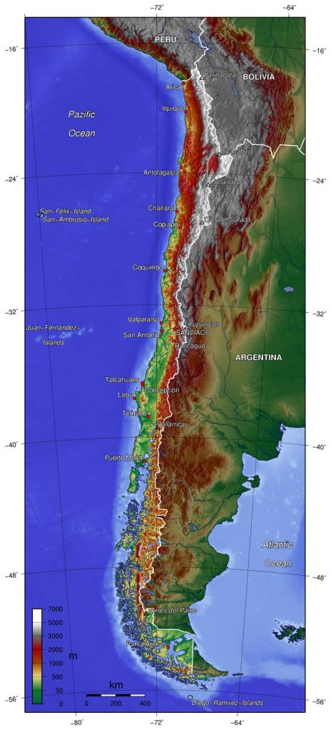
One of the most important aspects of Chile’s geography to understand is the role of the Andes mountain range. Chile is pinned between the Pacific Ocean and the Andes, one of the highest mountain chains on the planet. This affects Chile from north to south in a range of ways. In the north, it blocks the humid Amazon air, creating deserts. Further south it forces precipitation to fall resulting in dense rainforests.

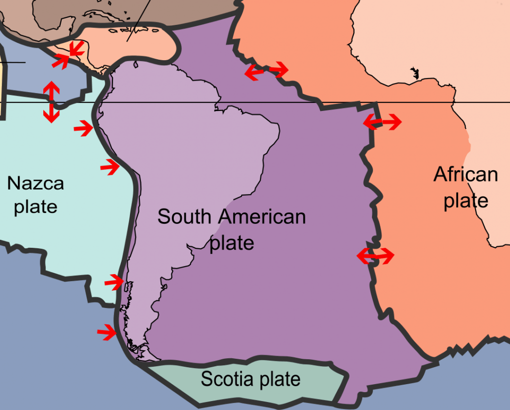
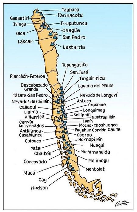
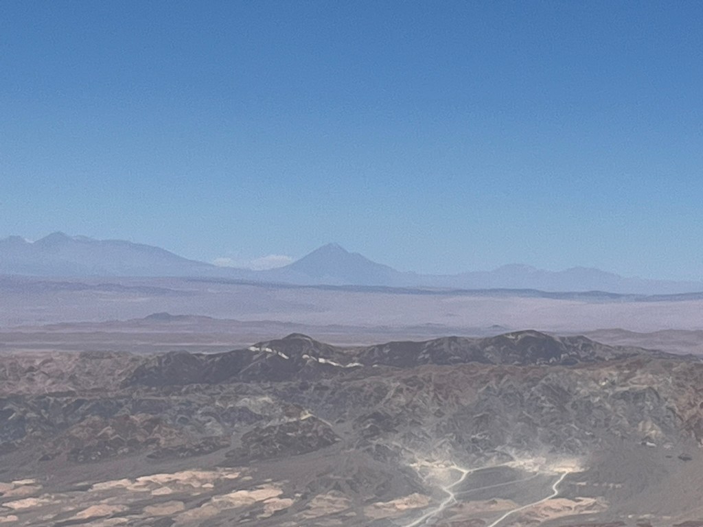
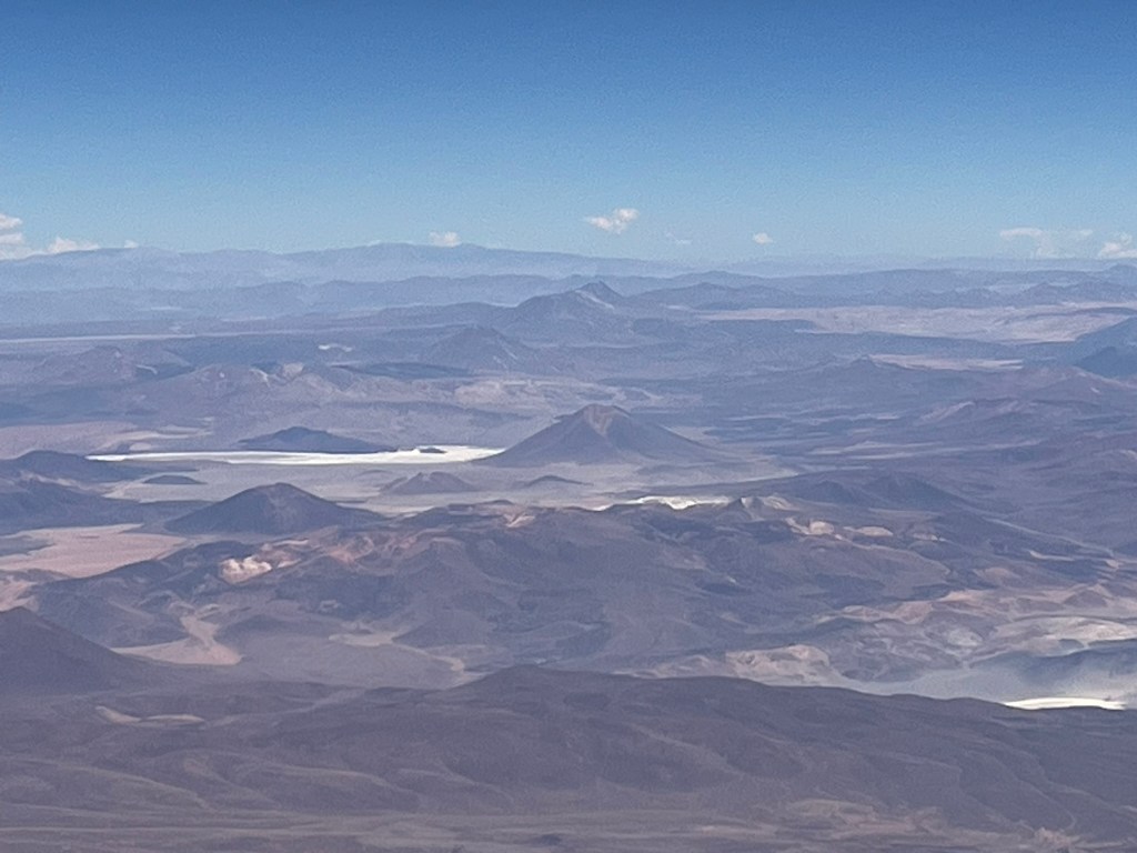
The other important aspect of this mountain range to consider is that it is volcanic, sitting on top of one of the most powerful and long-running subduction zones on earth. Along the entire west coast of South America, the Nazca plate is being pushed under the South American plate, resulting in mountains, earthquakes and volcanoes. There are over 2000 volcanoes along the Andes range of which ~90 are active. This is around 10% of all active volcanoes globally. I’ll talk about the natural hazard risks that Chile faces in a later blog, but for now it’s important because it creates some of dramatic landscapes that Chile is famous for.
Chile can be broken up into roughly 5 major geographical regions, that reflect its dramatic north-south gradients in climate, landforms and culture. Plus two special territories out in the Pacific Ocean.
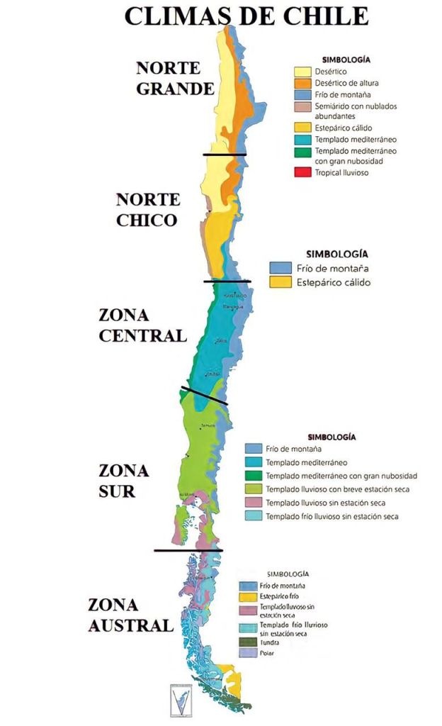
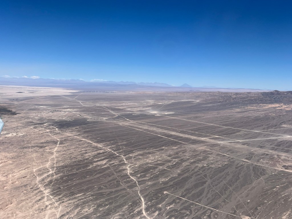
In the Norte Grande (Far North) you will find a hyper-arid desert climate. The region is dominated by the Atacama desert which is the driest non-polar desert on earth, high plateaus, salt flats, volcanoes and deep canyons. In the Atacama, some weather stations have never recorded rain. And the soil here resembles Mars so closely that NASA tests rovers in the region, and movies like Dune and The Mandalorian have been filmed here. Its dryness is caused by the combined effect of the Humboldt Current which brings cold water from Antarctica to the regions shores, creating an area of stable dry air, the Andes rain shadow which blocks humid Amazon air from reaching Chile, and high-pressure systems that develop over the Pacific. We are heading to this region to experience the desert and altiplano landscapes after return from Easter Island.

The Central Valleys region of Chile is its fertile, agricultural heart. It has a Mediterranean climate and is framed by the coastal range of mountains to the west and the Andes to the east. When travelling through this region expect to see rolling vineyards, orchards and farmland. This is also the economic core of the country and where the majority of the population lives. Both Santiago and Valparaiso are located in the central valleys region so we got to experience the climate of this part of Chile at the beginning of the trip.

Southern Chile has a temperate oceanic climate and is quite rainy. It contains dense temperate rainforests, a huge lakes district, snowy volcanic cones, rivers, waterfalls and lush vegetation. I won’t be visiting this region on my trip to Chile.
And finally, Zona Austral, or more commonly known as Patagonia is a subpolar climate. This is where you can find fjords, glacial channels, ice fields, and granite peaks like the famous Torres del Paine. There is steppe in the east and deep fjords in west of this region and it is often referred to as Chile’s wild frontier. This is where we will be heading after exploring the Atacama.

Leave a comment